Carling Creek Master Plan
About this project
The City of London has retained the services of Matrix Solutions Inc. (formerly Ecosystem Recovery Inc.) to undertake a Municipal Class Stormwater Management Master Plan and Environmental Assessment (MCEA) study for the Carling Creek subwatershed. The objective of the Carling Creek Stormwater Management Master Plan study is to develop a comprehensive long-term stormwater management strategy that addresses stormwater servicing deficiencies, surface flooding, and infrastructure renewal for existing and future land use within the area described as the ‘Core’ of the City of London. Long-term considerations include evaluating alternative options for strategic infrastructure upgrades, implementation of regional stormwater management systems, and the application of Low Impact Development (LID) solutions to achieve the desired level of stormwater servicing within the ‘Core’ study area. The stormwater management alternatives developed as part of the study will be evaluated based on level of service expectations, constructability, cost, environmental impacts, and adaptability to climate change.
The MCEA study will be completed in accordance with the Ontario Environmental Assessment Act and will follow approach #1 of the Municipal Engineers Association Municipal Class EA Master Plan process. The MCEA study will present sufficient detail to address Schedule A projects, including public and stakeholder consultation. Schedule B or C projects, namely recommended alternatives requiring the acquisition of private lands for regional stormwater management systems, will also be identified as part of the Master Plan study.
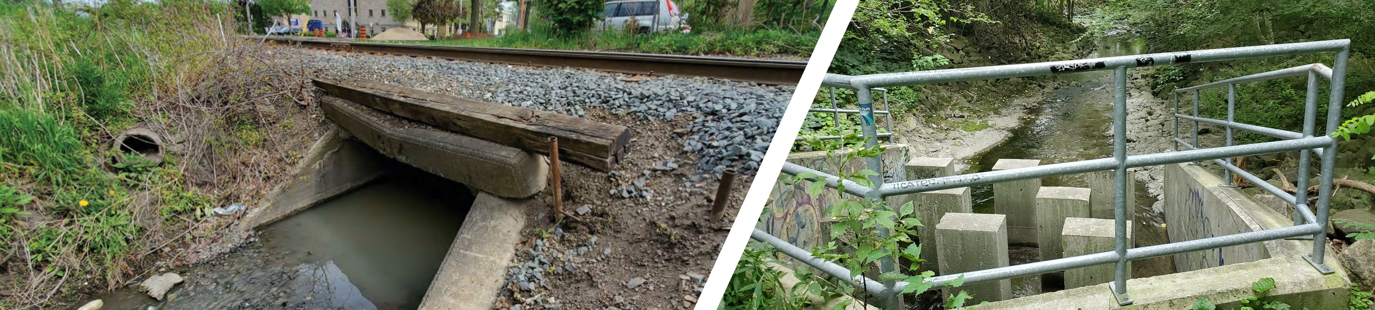
Carling Creek is a historic watercourse that flows west through the downtown ‘Core’ of the City of London. Dating back nearly 150 years, Carling Creek has evolved from a natural creek to an urban waterway, to an almost completely enclosed stormwater drainage system. The evolution of the watercourse, which at one point involved the construction of a dam across Richmond Street and the creation of a water body historically referred to as Lake Horn, has resulted in obstructed overland flow paths and flooding problems throughout the watershed.
The Carling Creek watershed is divided into two sections, a northern branch commonly referred to as Trunk A, and a southern branch with is comprised of two main trunk sewer, referred to as Trunk B and Trunk C. All three branches of the Carling Creek drainage system have a history of surface water flooding within municipal road right-of-ways and private properties.
Figure 1 shows the extent of watershed area and location of the Carling Creek primary trunk sewers that are being examined as part of the Carling Creek Stormwater Master Plan study.

Figure 1. Overview of the Carling Creek Stormwater Management Master Plan Study Area
Share your feedback
Public input is critical to the Master Plan process. The City would like anyone with an interest in Carling Creek to provide input, which will help the project team identify flooding concerns, develop stormwater management alternatives, and evaluate impacts from a broad range of potential improvement projects throughout the watershed. Please take the survey below, or contact the project team to share feedback.
-
Background information
Share Background information on Facebook Share Background information on Twitter Share Background information on Linkedin Email Background information linkWhat is a Stormwater Master Plan
Master Plans are long range plans which integrate infrastructure requirements for existing and future land use with environmental assessment planning principals.
A Stormwater Master Plan outlines the existing status of stormwater networks and includes guidelines and policies which dictate the management of stormwater over the next 5 to 10 years. The Master Plan approach emphasizes the importance of grouping related projects as parts of a system-wide long-term solution. This helps define the justification and context of individual projects with respect to the larger system while meeting the needs of the community and considering broader scale environmental impacts.
Typically, Master Plan Reports are revisited on a 5 to 10-year basis to ensure that conditions with respect to the social, economic, and natural environments are consistent with the evaluation in the Master Plan. If conditions have changed sufficiently to prevent implementation of the preferred alternative, an addendum to the Master Plan may be prepared for a specific project.
The City’s Official Plan
The London Plan (The Plan) was approved in 2016 and outlines the development and restructuring plans for the city for the proceeding 20 years. Storm water infrastructure goals and requirements are highlighted in the London Plan (London, 2016: Section 475 - 477), including but not limited to, management of urban runoff, optimisation of cost, protection of natural heritage features, and promotion of stormwater management innovation.
The City of London’s Official Plan contains City Council’s goals, objectives and policies to guide the short term and long-term physical development of all land within the municipality. Lands in the Study Area are designated for a variety of uses, including Green Space, Neighbourhoods, Rapid Transit Corridor, Light and Heavy Industrial, and Urban Corridor.
Green Space lands are scattered throughout the Carling Creek catchment and typically represent public park areas. The Green Space lands identified in the study area are McMahen Park, Piccadilly Park, Doidge Park, Carling Park, Bellwood Park, Northern Victoria Park, and Queens Park. The Plan places high value on preserving Green Space and uses permitted within this designation are limited to non-intensive uses. Strict use and development restrictions apply to floodplain lands and environmentally sensitive areas, however only the open channel section downstream of the Carling Creek trunk sewers fall into this category.
What is Stormwater Conveyance
A Stormwater conveyance system is a network of overland and subsurface conduits which conveys water off the land after rain or snowmelt. Stormwater conveyance systems typically include storm sewers, ditches, roads, municipal drains, creeks and rivers.
The Stormwater Conveyance System is divided into two components:
- The Minor System, which refers to the catch basins, maintenance holes and pipes (sewers) that convey stormwater below the ground. The minor system is designed to convey smaller, frequent rainfall events such as the 1 in 2-year (1:2-year) or 1:5-year storm event; and,
- The Major System which refers to the roads and ditches that convey stormwater above ground (also referred to as overland flow). The major system is designed to convey larger, infrequent rainfall events.
The minor and major system are generally sized to meet specific design criteria. The systems ability to meet specific design criteria is used to describe an assessed level of service, an evaluation criterion typically incorporated into a Master Plan and often used as a basis for comparison for improvement alternatives. Flooding of private property will occur when a rainfall event exceeds the design capacity of the Stormwater Conveyance System. An example of the minor and major system is illustrated in Figure 2.

Figure 2. Examples of Minor and Major System Conveyance
Many of the storm sewers that make up the minor system within the Carling Creek study area have deficient capacity to convey the stormwater runoff generated by the 1:2-year and 1:5-year storms. Additionally, and somewhat unique to the Carling Creek watershed, all stormwater runoff generated within the nearly 500 Ha Carling Creek catchment drains to 3 trunk sewers. The full urban drainage system offers very little conveyance through naturalized open-channel features, severely reducing online storage characteristics, leading to frequent exceedances of the capacity of the minor system.
The Carling Creek drainage system has continuously evolved since the natural creek system was originally enclosed. Hundreds of pipe components have been added over the years, creating a complex network of storm water infrastructure with variable aged pipes. Since significant portions of the system have been in place for over a century, concerns have been raised regarding the condition and integrity of sections of the system. The Carling Creek catchment has over 17.6 km of storm sewer constructed prior to 1940, well beyond the infrastructures normal 75-year lifespan, with 2.9 km of pipe constructed prior to 1901. Figure 3 shows the age of the storm sewer network within the Carling Creek catchment.

Figure 3. Age of Existing Storm Sewer Infrastructure
Historic Flooding
Over the last several decades flooding concerns have been raised within the study area by residents throughout the Carling Creek watershed (Figure 4). The flooding concerns noted were collected through emails to the City of London as voluntary submissions. 14 instances flooding were reported within the study area, with 1/3 of reported property flooding occurring near the Queens Avenue and Ontario Street intersection. The Queens Avenue and Ontario Street intersection is located in close proximity to the Queens Avenue ponding location mentioned in the Core Area Servicing Study (CASS, AECOM 2018) and likely results due to an absence of major system (overland) conveyance in the area.

Figure 4. Historic Flooding Reports
Strategies For Increased Level of Service and Flooding Reduction
In general there are two main strategies to improve the level of service and reducing the impacts of flooding of the minor system; improved system conveyance and increased storage characteristics. Conveyance strategies improve the capacity of the minor system by increasing pipe sizes, thus allowing more water to flow through the minor system before surcharging and resultant flooding occurs. Storage solutions attenuate flow by storing water in surface basins or underground storage tanks during storm events thereby allowing for a slower release of water to the minor system at a rate that does not result in surcharging. Both conveyance and storage solutions will be considered in the Master Plan for the Carling Creek watershed area. It is anticipated that the ultimate servicing solution for the Carling Creek watershed will be a combination of both storage and conveyance improvements with a focus on reducing flooding impacts on private properties and in areas where the accumulation of surface water runoff impedes the vehicular movement along critical transportation corridors within the City’s downtown core.
Low Impact Development Stormwater Management Solutions
The City London has expressed a strong interest in creating low impact development (LID) solutions to address the surface flooding issues in the Carling Creek catchment, in accordance with the City’s Official plan. LIDs are systems which reduce the volume of runoff, often more closely replicating natural processes of infiltration, evaporation, and water storage. Similar to pilot studies undertake by the City of London, there are areas within the study area that could be used to effectively implement effective LID alternatives such as boulevard areas along municipal roadways, City owned recreational facilities and park-land, and greenspace adjacent to ecologically sensitive areas (creation of naturalized buffers). Typical LIDs include but are not limited to:
- Bioswales
- Bioretention Cells
- Rain Gardens
- Rain Barrels
- Permeable Pavement
- Subsurface Infiltration Chambers
LID alternatives can be effective attenuation solutions allowing for a reduction in stormwater runoff volumes and natural processes such as infiltration to provide relief for overburdened stormwater infrastructure or to provide additional climate change resilience. Most LID measures depend on favorable soil conditions to provide a reduction in stormwater runoff volumes therefore are not as broadly applicable as pipe upsizing or other traditional storage stormwater management solutions. A broad range of LID solutions will be considered for implementation throughout the Carling Creek subwatershed as part of the Master Plan stormwater management solution for the downtown core.